
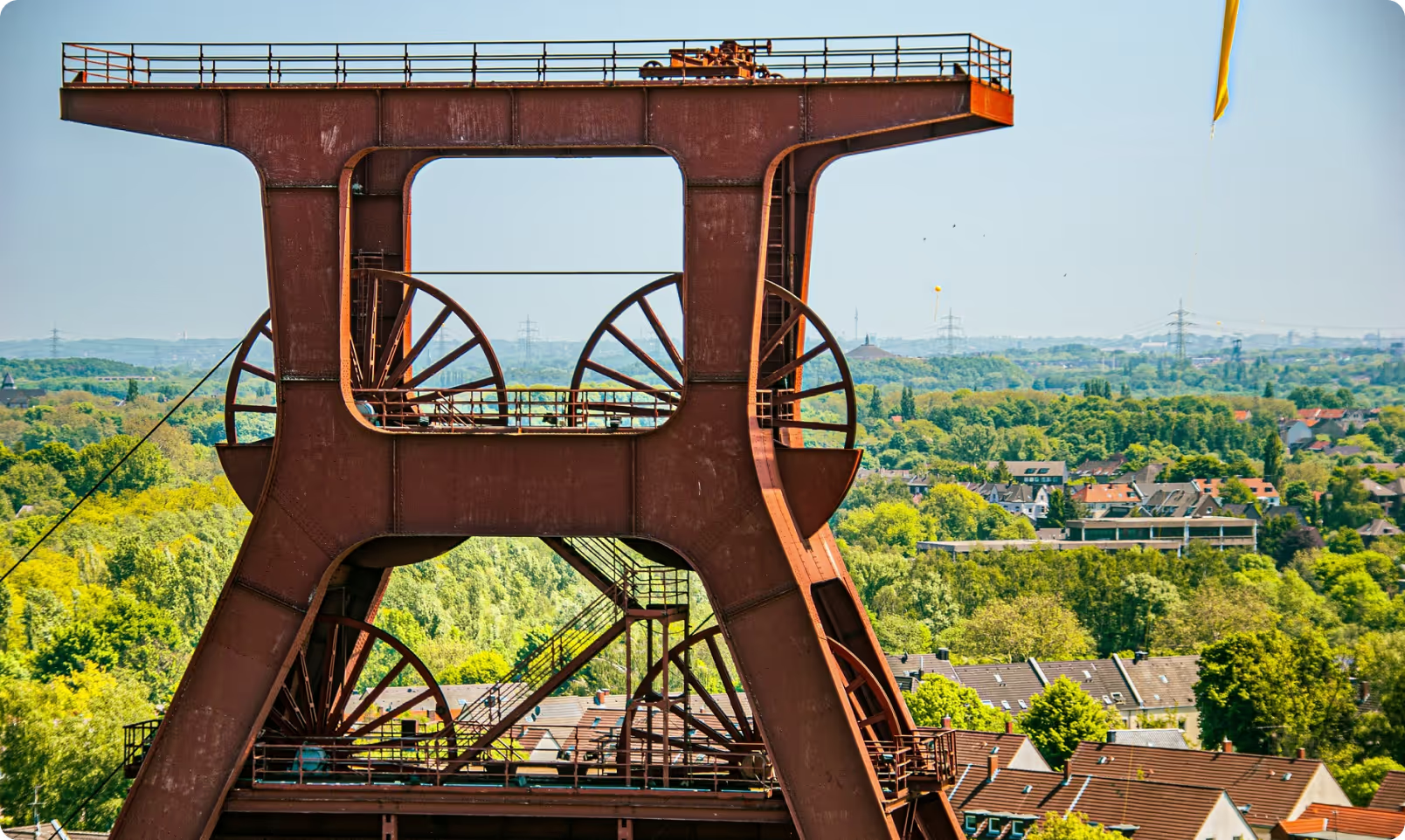
Geospatial solutions
bespoke software
Tailored for user-friendliness, our bespoke solutions elevate your geospatial data, ensuring seamless interactions and delivering immediate, valuable insights that drive success.
data analytics
Utilizing cutting-edge analytics tools, we turn raw data into actionable insights, aiding you in making informed choices and uncovering hidden patterns.
geoAI solutions
Engineered with a focus on operational efficiency, our GeoAI solutions breathe life into your geospatial datasets, offering effortless interactions paired with timely, in-depth insights that transform raw data into actionable intelligence.
Research & Development
Collaborating closely with academia and industry experts, we embark on exploratory journeys to unravel the complexities of the geospatial domain, driving innovation and expanding knowledge horizons.
Geospatial solutions
.png)
Store Locator
Utilizing advanced mapping technologies our Store Locator solution revolutionizes the way customers find the nearest retail locations carrying their desired products by providing on-the-ground data in a seamless, integrated format. This template integrates effortlessly with websites, delivering an intuitive, responsive and user-friendly interface that caters to both technical and non-technical users. Features include dynamic search filters, detailed store information, and interactive maps, ensuring a smooth and efficient user experience. The Store Locator not only drives in-store traffic but also supports the mission of delivering premium products to a broader audience.
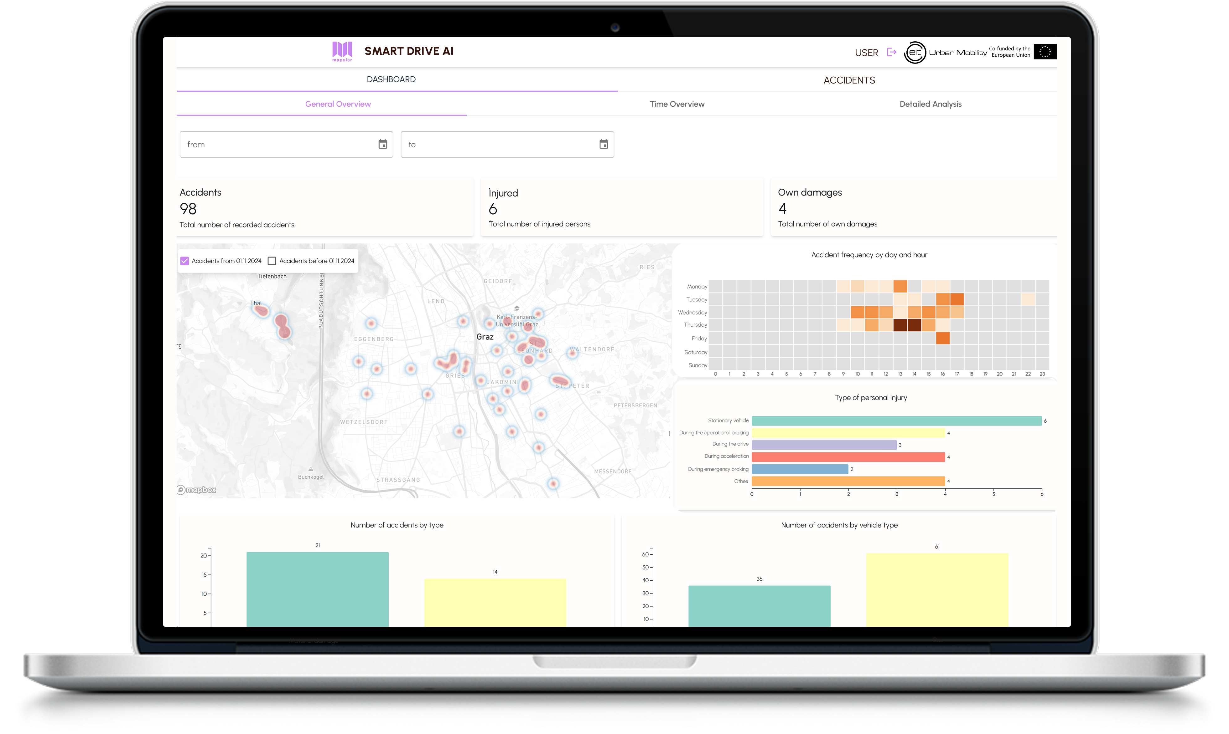
Smart Drive ai
SmartDrive AI is a real-time accident reporting and safety intelligence solution for urban transit. In partnership with Graz Linien and EIT Urban Mobility, it digitizes incident documentation with GPS-tagged reports, transforming them into actionable insights.By mapping high-risk areas and analyzing patterns, SmartDrive AI helps prevent future accidents and improves driver safety. From faster reporting to smarter interventions, it’s a powerful tool for building safer, more responsive transit systems.
EIT Urban Mobility is supported by the European Institute of Innovation and Technology (EIT), a body of the European Union.

.png)
Smart Sites
We have crafted an AI-powered site selection solution that streamlines the identification process for retail and real-estate locations. The tool not only finds the optimal location but also provides valuable information on how this location was determined and how it compares to other potential sites. By integrating environmental and economic factors with location data, our platform significantly reduces manual efforts, simplifies complex information analysis, and minimizes risk. This innovative approach enhances efficiency, accelerates time to market, cuts external costs, and improves accuracy. Businesses can bolster strategic planning with comprehensive data insights in demographic and socioeconomic data, daytime and nighttime population data, market segmentation and consumer styles, commercial facility details, competitor analysis, and more.
join our approach for co-development

customization
Each package can be further tailored to your needs. Prices may vary based on additional service requirements.
flexibility
Services can be adjusted in scope with potential impact on price and timeline.
quality assurance
All services include Mapular’s guarantee for quality and customer satisfaction.
Thanks to Smart Drive AI, our drivers can digitally record accident data. Additionally, the dashboard allows our accident manager to analyze the data, enabling targeted accident prevention measures. Mapular works with great focus, reliability, and professionalism. It was a pleasure working with them.

We are so excited to work with mapular as our full-service geomarketing partner. The custom store locator map their team built for Black Buffalo is truly the best I've seen in the industry and resulted in immediate ROI in terms of consumer engagement, retail foot traffic, and industry attention. Beyond the consumer-facing store locator map, mapular brings to our team a wealth of analytical knowledge that's helping us make high-level decisions at the retail level where otherwise we would be completely in the dark.
"Mapular supports our work in species conservation and the reforestation of tropical rainforests with its wonderful expertise. It is only thanks to their know-how that we at BOS Deutschland e.V. have been able to realize our project Lebenswald.org in the way we envisioned it. Thank you for the wonderful cooperation."
Mapular's exceptional geospatial expertise was pivotal in designing and implementing our blue carbon platform during an 8-week project. Their meticulous planning and flawless execution exceeded our expectations, making them our preferred partner. We've already engaged Mapular for another phase of work, confident in their ability to consistently deliver outstanding results.

use cases
.avif)
EIT UM Raptor - SmartDrive AI
EIT UM & Graz Linien
Together with Graz Linien and the EIT UM, we are working on the SmartDrive AI solution, a pioneering initiative aimed at enhancing road safety for Graz Linien drivers. This project focuses on real-time accident reporting, GPS-based location marking, and the integration of location data analysis to highlight high-risk areas, enabling drivers to prevent future accidents. Our role includes the digital transition of accident documentation and advanced data analysis, ultimately contributing to a safer urban environment.
EIT Urban Mobility is supported by the European Institute of Innovation and Technology (EIT), a body of the European Union.
KIMoDIs Research Project
BMBF
Together with the Karlsruhe Institute of Technology, Technical University of Munich, and public organizations, we participate in a research project that aims to develop a monitoring, data management and information system based on artificial intelligence (AI) for the prediction of groundwater levels and salinization. Our task is to analyze the requirements and develop a prototype of a user-specific decision support system that is intended to provide early warning of groundwater low levels and salinization and the associated damage.

Biodiversity Net Gain Screening Tool
Biodiversify
For Biodiversify we built and implemented a software as a service application to allow users to analyse the Biodiversity Net Gain (BNG) implications of potential development sites. Biodiversify's BNG screening tool estimates the likely BNG implications of development sites. The tool uses advanced geospatial analysis to calculate the potential impact of development sites in terms of the Natural England Biodiversity Metric using the best nationally available data.
InnoMAUS Research Project
BMBF
Together with the University of Potsdam, Technical University of Munich and KISTERS, we participate in a research program that aims at the development and integration of innovative digital tools for the management of risks from heavy rain events in cities. Based on a hydrological model, we predict the infrastructure damage caused by extreme precipitation events and create a web-based decision support system with target group-specific storylines and dynamic infographics for better risk communication.
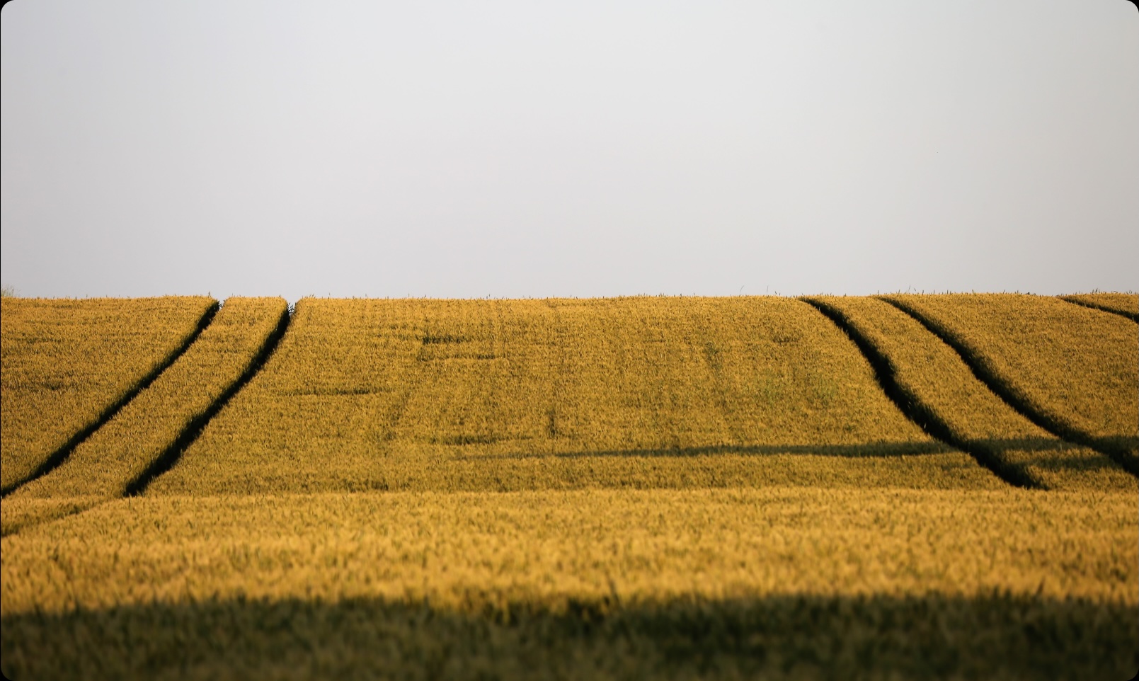
TecSAT Harvest Prognosis App
FarmChamps GmbH & Co. KG
FarmChamps uses a field vitality model to forecast harvest of crops for farmers and biofuel producers. We developed a web solution that empowers users to make informed decisions for day-to-day management of ground food production in order to understand the current crop status, plan more efficient harvests, and forecast likely yields.

Smart Weeding System
ENVU
Uncontrolled vegetation causes damages, delays and safety issues for railways. ENVU’s Smart Weeding System uses weed detection technology to perform precision spraying of herbicides only where weed is present. The approach reduces the amount of herbicides by up to 50 %. We helped ENVU develop and implement a digital platform for their customers to process the spraying data and to visualize and monitor the maintenance activities and results.
Blue Carbon Marketplace
TransparenC
The Blue Carbon Marketplace, developed for our client TransparenC, represents a significant stride in combating the climate crisis by leveraging the voluntary carbon market. This innovative platform is crucial as it facilitates the trading and management of carbon credits derived from blue carbon ecosystems, like mangroves, seagrasses, and salt marshes, which are vital in sequestering carbon dioxide, a major greenhouse gas. Additionally, the Blue Carbon Marketplace harnesses the power of geospatial data analytics, utilizing satellite imagery and other spatial data sources to accurately monitor and verify the carbon sequestration impact of each project.
KIMoDIs Research Project
BMBF
Together with the Karlsruhe Institute of Technology, Technical University of Munich, and public organizations, we participate in a research project that aims to develop a monitoring, data management and information system based on artificial intelligence (AI) for the prediction of groundwater levels and salinization. Our task is to analyze the requirements and develop a prototype of a user-specific decision support system that is intended to provide early warning of groundwater low levels and salinization and the associated damage.
Biodiversity Net Gain Screening Tool
Biodiversify
For Biodiversify we built and implemented a software as a service application to allow users to analyse the Biodiversity Net Gain (BNG) implications of potential development sites. Biodiversify's BNG screening tool estimates the likely BNG implications of development sites. The tool uses advanced geospatial analysis to calculate the potential impact of development sites in terms of the Natural England Biodiversity Metric using the best nationally available data.

Smart Sites Renewable Energy
We developed an intuitive self-service web application that integrates wind speed, flood hazard, and accessibility data to assess the most suitable locations for wind turbines by applying different criteria specified by the user. The tool provides a comprehensive map visualization and enables the user to see more details about the top 10 sites based on the selected criteria.
InnoMAUS Research Project
BMBF
Together with the University of Potsdam, Technical University of Munich and KISTERS, we participate in a research program that aims at the development and integration of innovative digital tools for the management of risks from heavy rain events in cities. Based on a hydrological model, we predict the infrastructure damage caused by extreme precipitation events and create a web-based decision support system with target group-specific storylines and dynamic infographics for better risk communication.
TecSAT Harvest Prognosis App
FarmChamps GmbH & Co. KG
FarmChamps uses a field vitality model to forecast harvest of crops for farmers and biofuel producers. We developed a web solution that empowers users to make informed decisions for day-to-day management of ground food production in order to understand the current crop status, plan more efficient harvests, and forecast likely yields.
Smart Weeding System
ENVU
Uncontrolled vegetation causes damages, delays and safety issues for railways. ENVU’s Smart Weeding System uses weed detection technology to perform precision spraying of herbicides only where weed is present. The approach reduces the amount of herbicides by up to 50 %. We helped ENVU develop and implement a digital platform for their customers to process the spraying data and to visualize and monitor the maintenance activities and results.

Lebenswald Donation Platform
BOS
Lebenswald creates new habitats, protects endangered species and actively fights against climate change. The initiative Lebenswald is part of Borneo Orangutan Survival (BOS) that saves the acutely endangered orangutans in Borneo. Together we developed a map-focused, donation platform that engages with donors allowing them to select their region for planting.

Monitoring Training for Coffee Farmers in Africa
HereWeGrow
We supported HereWeGrow with the implementation and execution of a large-scale training program. The goal was to improve coffee yield and quality to raise the household income of 50,000 coffee farmers in Ethiopia. We built and implemented a system for monitoring and evaluation of the training offering, attendance tracking, training module navigation with data collection, and farm visit surveys.

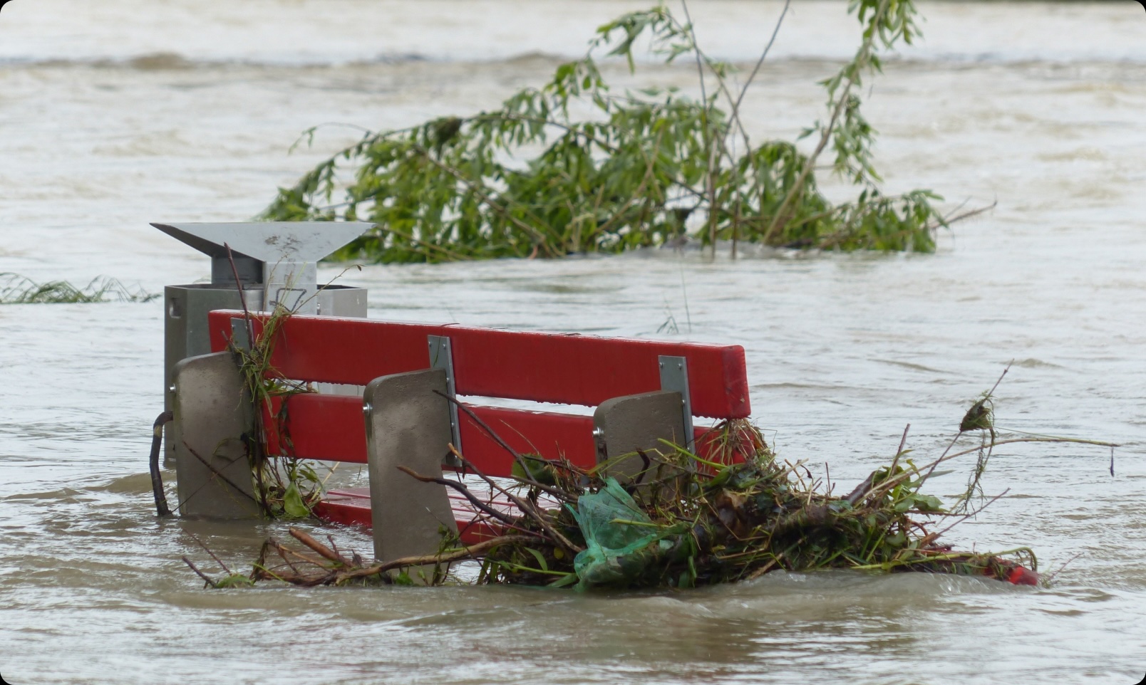
Stormwater Emergency Management Tool
EGLV
Working with EGLV, we instrumented the digitization of task-allocation to improve situational awareness, task dispatching and workforce management during flooding events. Management and workers alike are situationally aware in real time.

Black Buffalo Store Locator
Black Buffalo
The Store Locator was developed to enhance the customer experience by making it easier for users to find retail locations that carry Black Buffalo products. Leveraging cutting-edge location services, we created a seamless solution that is fully integrated into the Black Buffalo website, offering an intuitive, responsive, and user-friendly interface. The solution features dynamic search filters, comprehensive store details, and interactive maps to ensure a smooth and efficient user experience. By driving more in-store traffic, the Store Locator supports Black Buffalo's mission to expand the availability of their premium products to a broader audience.
EIT UM Raptor - SmartDrive AI
EIT UM & Graz Linien
Together with Graz Linien and the EIT UM, we are working on the SmartDrive AI solution, a pioneering initiative aimed at enhancing road safety for Graz Linien drivers. This project focuses on real-time accident reporting, GPS-based location marking, and the integration of location data analysis to highlight high-risk areas, enabling drivers to prevent future accidents. Our role includes the digital transition of accident documentation and advanced data analysis, ultimately contributing to a safer urban environment.
EIT Urban Mobility is supported by the European Institute of Innovation and Technology (EIT), a body of the European Union.
Claim Predictor
RAG
Together with RAG, we are supporting safety and sustainability in the Ruhr region. Despite all prevention efforts, property damages caused by former mining activities are still common. We brought in new spatial data to augment the existing complex RAG mining and claims data. We trained and validated a spatio-temporal model for prediction of future claims. The prediction outputs are visualized and integrated as a service layer into existing RAG systems.
Smart Sites Renewable Energy
We developed an intuitive self-service web application that integrates wind speed, flood hazard, and accessibility data to assess the most suitable locations for wind turbines by applying different criteria specified by the user. The tool provides a comprehensive map visualization and enables the user to see more details about the top 10 sites based on the selected criteria.

Smart Sites Retail
We developed an intuitive self-service web application that integrates demographics, accessibility, and property data to compare existing, future, and competitor retail locations. The application provides a comprehensive KPI visualization and an AI-powered prediction of site suitability.
Smart Weeding System
ENVU
Uncontrolled vegetation causes damages, delays and safety issues for railways. ENVU’s Smart Weeding System uses weed detection technology to perform precision spraying of herbicides only where weed is present. The approach reduces the amount of herbicides by up to 50 %. We helped ENVU develop and implement a digital platform for their customers to process the spraying data and to visualize and monitor the maintenance activities and results.
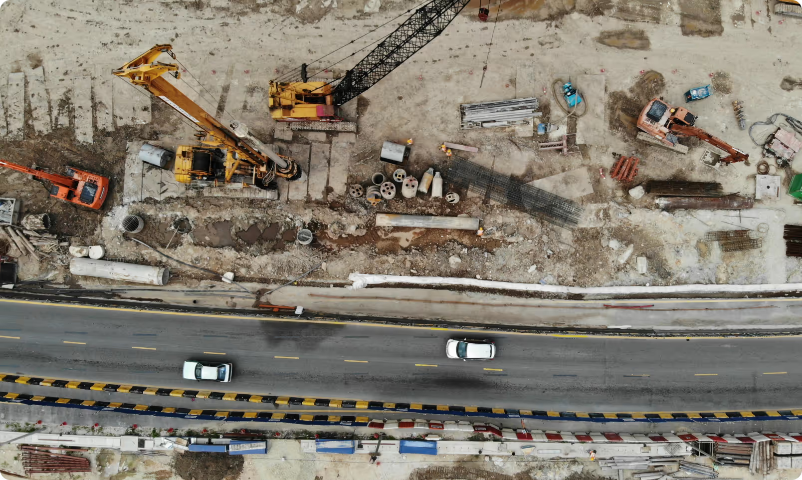
Supply Chain GIS and Data Visualization Tool
ThyssenKrupp Industrial Solutions AG
We developed an automatic progress tracking solution for ThyssenKrupp’s large construction sites using imagery collected from drones. The award winning solution combines 3D geospatial datasets and artificial intelligence for smart, autonomous feature recognition and automated reporting.
Lebenswald Donation Platform
BOS
Lebenswald creates new habitats, protects endangered species and actively fights against climate change. The initiative Lebenswald is part of Borneo Orangutan Survival (BOS) that saves the acutely endangered orangutans in Borneo. Together we developed a map-focused, donation platform that engages with donors allowing them to select their region for planting.
Monitoring Training for Coffee Farmers in Africa
HereWeGrow
We supported HereWeGrow with the implementation and execution of a large-scale training program. The goal was to improve coffee yield and quality to raise the household income of 50,000 coffee farmers in Ethiopia. We built and implemented a system for monitoring and evaluation of the training offering, attendance tracking, training module navigation with data collection, and farm visit surveys.
EIT UM Raptor - SmartDrive AI
EIT UM & Graz Linien
Together with Graz Linien and the EIT UM, we are working on the SmartDrive AI solution, a pioneering initiative aimed at enhancing road safety for Graz Linien drivers. This project focuses on real-time accident reporting, GPS-based location marking, and the integration of location data analysis to highlight high-risk areas, enabling drivers to prevent future accidents. Our role includes the digital transition of accident documentation and advanced data analysis, ultimately contributing to a safer urban environment.
EIT Urban Mobility is supported by the European Institute of Innovation and Technology (EIT), a body of the European Union.
KIMoDIs Research Project
BMBF
Together with the Karlsruhe Institute of Technology, Technical University of Munich, and public organizations, we participate in a research project that aims to develop a monitoring, data management and information system based on artificial intelligence (AI) for the prediction of groundwater levels and salinization. Our task is to analyze the requirements and develop a prototype of a user-specific decision support system that is intended to provide early warning of groundwater low levels and salinization and the associated damage.
InnoMAUS Research Project
BMBF
Together with the University of Potsdam, Technical University of Munich and KISTERS, we participate in a research program that aims at the development and integration of innovative digital tools for the management of risks from heavy rain events in cities. Based on a hydrological model, we predict the infrastructure damage caused by extreme precipitation events and create a web-based decision support system with target group-specific storylines and dynamic infographics for better risk communication.
get in touch
Unlock the potential of location intelligence with our advanced geospatial and mapping technologies. Whether you need modular solutions or custom services, we offer tools to transform data into beautiful, actionable insights. Our products are designed to enhance efficiency, drive innovation, and create compelling mapping experiences tailored to your needs.


IMPRINT
Information in accordance with § 5 DDG:
Mapular UG (haftungsbeschränkt)
c/o TOG The Office Group
(Germany) GmbH
Kronenstraße 63
10117 Berlin
Germany
Contact:
Phone: +49 30 20994953
E-mail: info@mapular.com
Authorized Representatives:
Peter Rose, Managing Director,
Finn Geiger, Managing Director
Commercial Register:
Registration Number: HRB 198464 B
Registration Court: Amtsgericht Charlottenburg
VAT ID:
DE319612636
Responsible for the content according to § 55(2) RStV:
Peter Rose
TOG The Office Group
(Germany) GmbH
Kronenstraße 63
10117 Berlin
Germany
EU Dispute Resolution
The European Commission provides a platform for online dispute resolution (ODR): https://ec.europa.eu/consumers/odr. Our e-mail address can be found above in the site notice.
We are not willing or obliged to participate in dispute resolution proceedings before a consumer arbitration board.
Liability for Contents
As service providers, we are liable for our own content on these websites in accordance with Paragraph 7, Sect. 1 of the German Digital Services Act (DDG). However, service providers are not obligated to permanently monitor the information they submit or store, or to search for evidence that indicates illegal activities, in accordance with Paragraphs 8 to 10 of the DDG.
Legal obligations to remove information or block the use of information remain in force. In this case, liability is only possible from the time of knowledge of a specific infringement. Illegal content will be removed immediately upon our becoming aware of it.
Liability for Links
Our offer includes links to external third-party websites over which we have no control. Therefore, we cannot assume any liability for these external contents. The respective provider or operator of the pages is always responsible for the contents of the linked pages.
The linked pages were checked for possible legal violations at the time of linking. No illegal content was found at the time of linking. A permanent control of the content of linked websites is not reasonable without concrete evidence of a violation of the law. If we become aware of any infringements, we will remove such links immediately.
Copyright
The content and works created by the site operators on these pages are subject to German copyright law. Duplication, processing, distribution, and any form of commercialization of such material beyond the scope of the copyright law require the express written consent of the copyright holder.
Copies and downloads of this site are only permitted for private, non-commercial use. Insofar as the content on this site was not created by the operator, the copyrights of third parties are respected. In particular, content from third parties is marked as such. If you nonetheless become aware of a copyright infringement, we would ask you to notify us accordingly. If we become aware of any legal infringements, we will remove such content immediately.
Copyright Notice
© 2025 Mapular UG (haftungsbeschränkt). All rights reserved.