Data Product
Unified Geospatial Data
for Site Evaluation.
We unify planning, zoning, infrastructure and demographic data from all 16 federal states into one model for faster, consistent analysis, usable in GIS or our explorer tool.
The Challenge
The Same Data Challenges, Every Project
Every planning or development workflow faces fragmented data, manual research, and delayed access to opportunities.
Fragmented Public Data
Planning information is published differently across states, making cross-regional analysis slow and error-prone.
Manual Research Workflows
Hours spent searching multiple sources for B-Plans, parcel information, and zoning details.
Delayed Access
Limited digitisation means development plans are discovered too late, and opportunities pass before you see them.
The Solution
One Harmonised Dataset. Weekly Updates.
Mapular consolidates fragmented public planning, zoning, infrastructure and demographic data into one unified structure, updated weekly with the latest publicly available information.
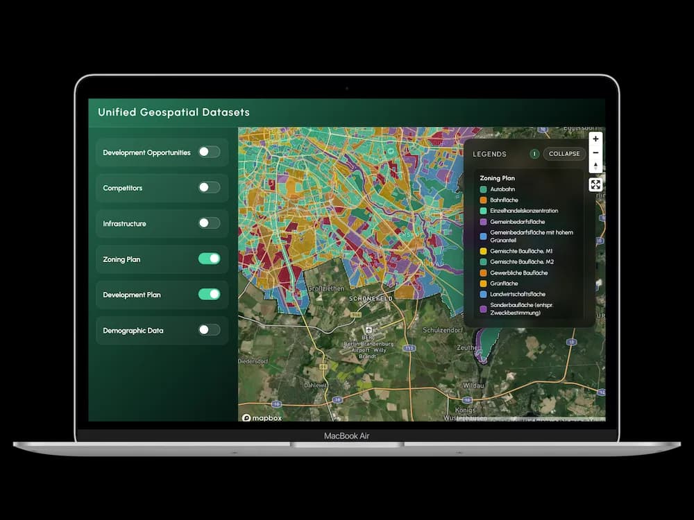
Data Layers
Filter. Analyse. Decide.
Available layers across all 16 German states.
Land-Use Plans
Flaechennutzungsplan data including commercial and industrial zones.
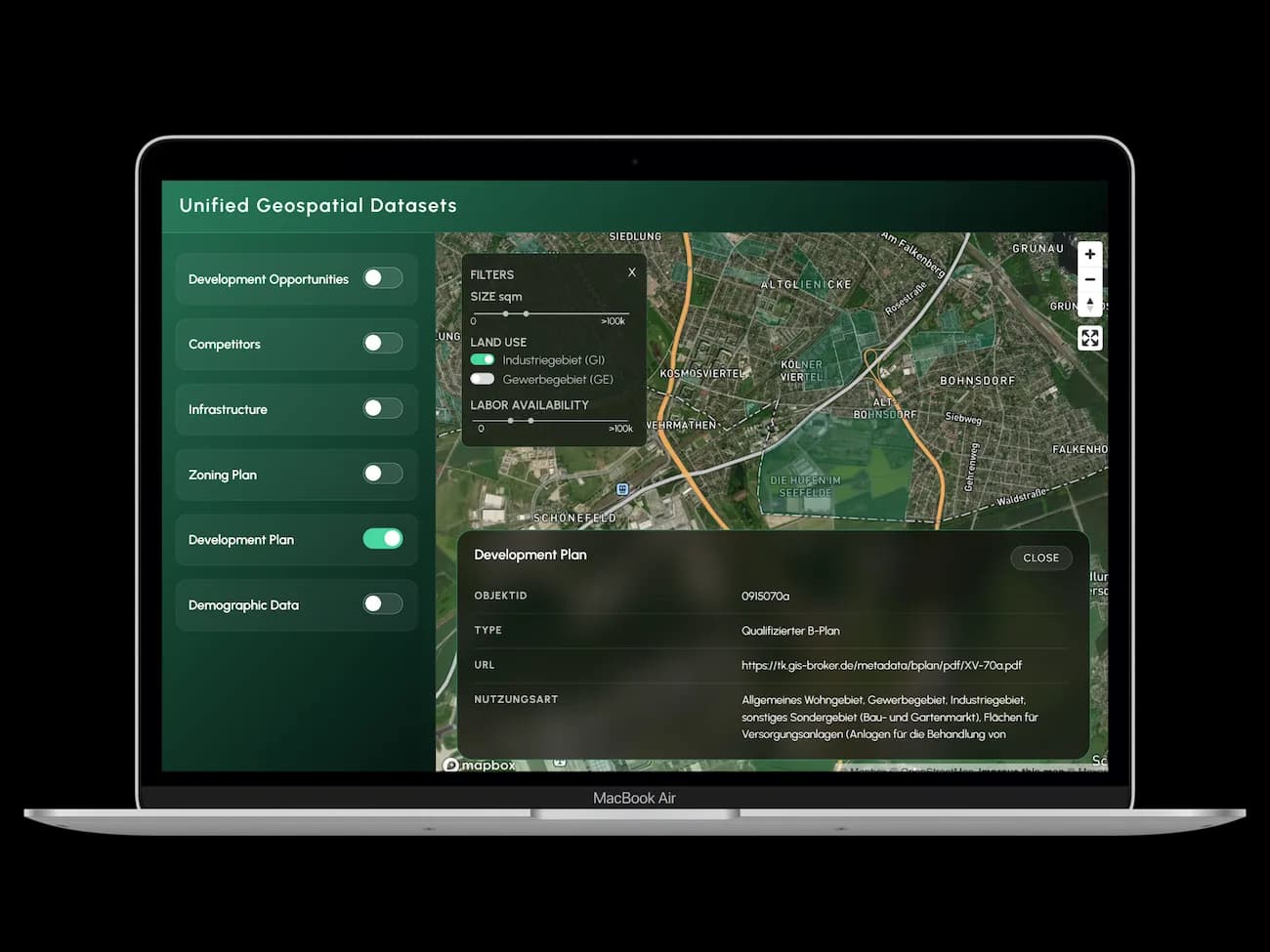
Zoning / B-Plans
Development plans with Gewerbegebiet and Industriegebiet designations.
Infrastructure Proximity
Motorway access, rail connections, and transport links.
Labour Availability
Workforce indicators by region.
Parcel Data
Filterable by size, use type, and availability.
Demographics
Socio-demographic data at granular geographic levels.
Coverage
All 16 Federal States
Baden-Wuerttemberg, Brandenburg, Berlin, NRW, Rhineland-Palatinate, Saxony, Schleswig-Holstein, Thuringia
Bavaria, Hesse, Lower Saxony, Saarland, Mecklenburg-Vorpommern, Hamburg, Bremen
Saxony-Anhalt
Two Ways to Access
GIS or Explorer: Your Choice
Unified Geospatial Dataset
Ready for direct integration into your GIS, CAD, or BI tools. Standard formats, documented schema.
Mapular Explorer
Instant planning interface, no GIS setup required. Filter, analyse, and export from your browser.
Use Cases
Built for Multiple Workflows
Infrastructure & Utilities Planning
Real Estate Development & Site Evaluation
Industrial & Logistics Site Scouting
Retail Network Planning
Consulting & Advisory
Public Sector & Economic Development
Working with Mapular will allow us to streamline the integration of geospatial data across German states. Their dynamic data pipeline made it simple to unify and standardize our datasets, creating a scalable foundation for future projects.
FAQ
Common Questions
What geospatial datasets does Mapular offer?
Mapular provides foot traffic data, demographic profiles, points of interest, land-use and zoning plans, infrastructure proximity, mobility patterns, and spending indicators. All datasets are pre-harmonized and ready to use without manual research.
How is the data delivered?
You can access the data via API, bulk download, or direct integration into your GIS, CAD, or BI tools. The Mapular Explorer also provides a browser-based interface if you prefer to filter and analyze without any technical setup.
How often is the data updated?
Update frequency depends on the data source. Planning and zoning data is refreshed weekly as new public records become available. Demographic and infrastructure data follows monthly or quarterly update cycles.
Can I get data for a custom geographic area?
Yes. You can define your area of interest using custom polygons, postal codes, or administrative boundaries. Mapular delivers the relevant dataset clipped to your specified geography.
Is the data GDPR-compliant?
Yes. All data provided by Mapular is aggregated and anonymized. No individual-level personal data is included. The datasets are fully compliant with GDPR requirements.
Ready?
See Mapular
in Action.
Book a free 30-minute demo. We'll show you exactly how the platform works for your use case, with no generic slides and no obligation.